Shirakami Mountains: Recommended Walks
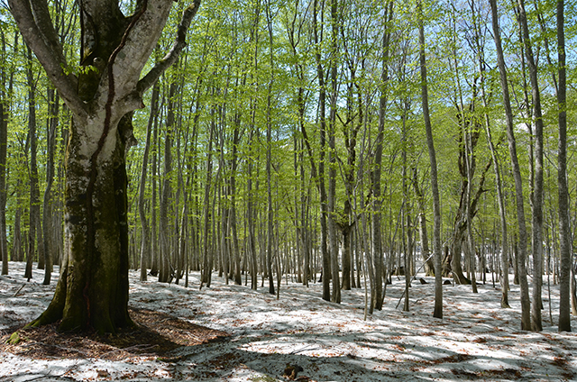
1. Education Forest for Daketai Nature Observation
→45-minute drive from the center to the forest
The best walking course in the Shirakami area for beginners!
This course is allows anyone to take a trip through a pristine beech forest. It similar to the World Heritage forest of Shirakami. Within just a short five-minute walk from the parking, you will encounter the tree like a majestic Lord of the Shirakami Forest, a 400-year-old beech.
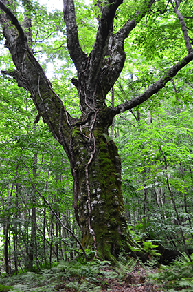
Mt. Daketai’s 400-year-old Beech Tree
The large beech tree has become a symbol of Shirakami-Sanchi.It is 400 years old – its gnarled, bumpy bark conveys their age. Fern, moss, and a Climbing Hydrangea have all lived here with.
※The tree fell in the winter of 2022. Now its children are growing up and it have been returning to the earth to nourish them.
- Trunk circumference: 4.85m
- Height: 26m
- Estimated age: over 400 years
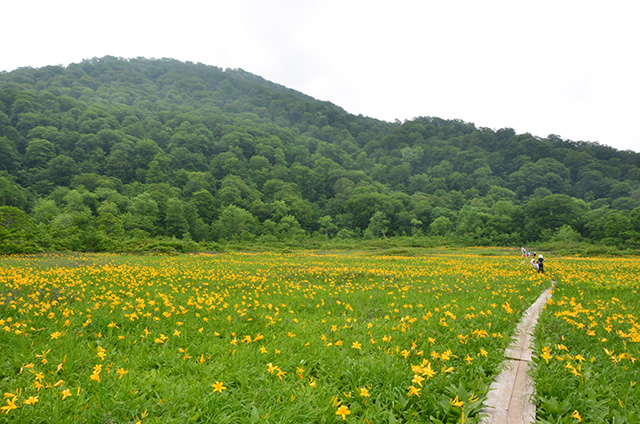
2. Tanashiro Marshland
→55-minute drive followed by a 15-minute walk from the center to the marshland
One of precious high moor in Shirakami-Sanchi.
In May, Asian skunk cabbage and marsh-marigold can be seen together with the residual snow. And then one ofter another between June and August, Daylily, Kinkoka and Tachigiboshi bloom in profusion.
In autumn, the marshland offers great open views and makes a wonderful place to take in the yellow hues of the beech forest leaves covering the surrounding mountainsides.
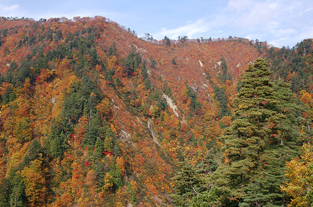
3. Tsurubeotoshi Pass
→50-minute drive from the center
A magnificent view point of Shirakami Forest’s autumnal faces.
Enjoy the contrasts in the face of the mountains of color between the reds of the broad-leaved trees, the yellows of the beeches, and the deep greens of the conifers. The best time to view them is mid- to late October.
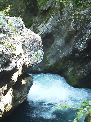
4. Sanjugama (Mase Gorge)
→75-minute drive from the center to the gorge
A beautiful gorge along Masegawa River that originated from Shirakami-Sanchi.
It is a perfect hiking trail with the pristine water rushing through uniquely shaped rocks and potholes (rock caves created over a long time by mountain stream). The trail is tended all the way from nearby Bunakko Land and is teeming with visitors when the leaves change color in autumn.
Photo credit: Association of Shirakami Nature (NPO)
Shirakami-Sanchi World Heritage Conservation Center, Fujisatokan Recommended Hiking Courses
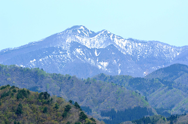
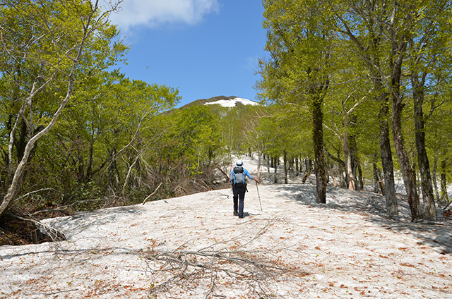
5. Mt. Fujisato-Komagatake, Kuroishi Hiking Course (Beginners’ Level)
→55-minute drive from the center to Mt. Fujisato-Komagatake
A route to reach the summit of Mt. Fujisato-Komagatake (1157 m)
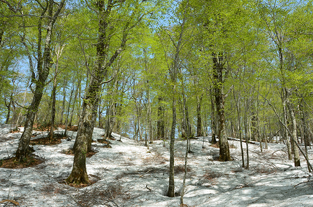
This is the shortest and most popular couse. Hikers get to walk through the floral Tanashiro Marshland and through the beech forest on the way to the peak.
The winter closure of the access road is scheduled to end on May 15, 2026
6. Mt. Fujisato-Komagatake, Kabadai Hiking Course (Intermediate Level)
→80-minute drive from the center to Mt. Fujisato-Komagamine
CAUTION: Forest road – surface turns to gravel
Another route to reach the summit of Mt. Fujisato-Komagatake
It is located in deep of the mountains, so it takes 1 hour to the start in unpaved road by car. It is longer couse than KuroishiーCouse. But it started in the primeval beech forest and walk along the ridge from Maedake peak towards the Komagatake peak, there is a phenomenal view of no gaps green canopy. Also, there is a rocky ridge just before the summit.
Unpaved access road is closed due to landslides and remaining snow (as of April 2026)
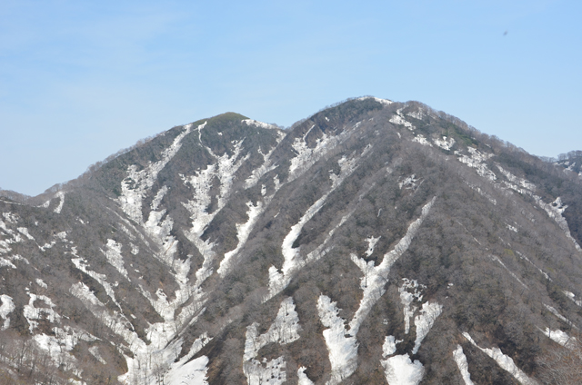
7. Mt. Kodake (Intermediate Level)
→120-minute drive from the center to Mt. Kodake
CAUTION: Forest road – surface turns to gravel
A route for the wondrous view point: Mt. Kodake (1042m).
The mountain is a the part of World Natural Heritage site. The westside of the ridge is a east end of the site. When you look to the Sea of Japan from the summit, your eyesite will be full of the world heritage forest canopy. While the almost trail is covered by beech, just below the summit – around 1000m elevation – is a belt of Siberian Dwarf Pines that can only grow wild at high mountains. This is another great Shirakami-Sanchi view!
Unpaved access road is closed due to landslides and remaining snow (as of April 2026)
8. Mt. Futatsumori (Beginners’ Level)
→105-minute drive from the center to Mt. Futatsumori
1086 meters elevation. Starting in the town of Happo by the Sea of Japan, the trail begins at the end of Seishu Rindo, which was planned to be constructed to link Nishimeya Village, Aomori Prefecture and Happo Town, Akita Prefecture. Its popularity stems from the fact that it lends good views of Shirakami-Sanchi, is a relatively light hike and because you can get into the World Heritage Area within five minutes of the start of the trail.
The road to access this area is currently closed. It is not yet known when it will be opened.
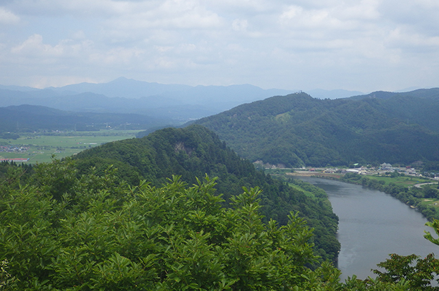
9. Nanakura Mountains (Beginners’ Level)
→25-minute drive from the center to Nanakura Mountains
Nanakura Mountains is a great place for a light trek. It offers its visitors a sense of history and the grandeur of a giant forest, and it is a mountain that is very much a part of the lives of the people who live around it. Nanakura Mountains’ name refers to the seven peaks -Nana means “seven” – of Gongenkura, Eboshikura, Minokura, Sanbonsugikura, Shibakura, Okura and Matsukura from which ridges rise towards the main peak while making Yoneshiro River narrow and meander. On the eastern slope spreads a magnificent mixed forest of natural Akita cedars as well as deciduous broad-leaved trees. Peering down from the observation deck, you can take in the townscape of Futatsui and Yoneshiro River, while if you look north, you’ll see the mountain scape of Shirakami-Sanchi.
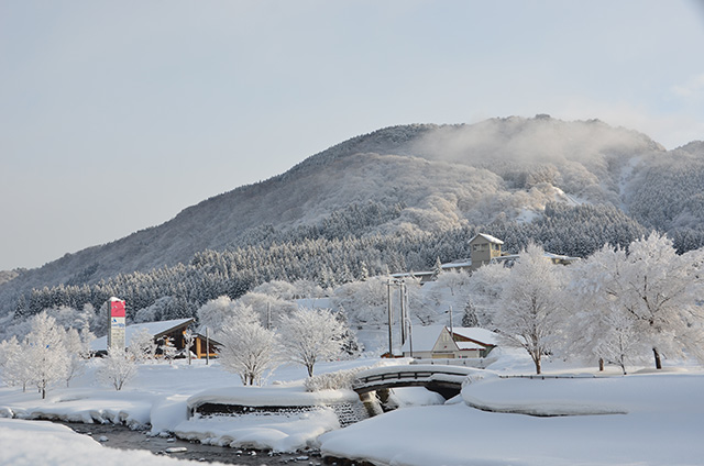
10. Mt. Takayama (Beginners’ Level)
→10-minute walk from the center to Mt. Takayama
Mt. Takayama (elevation: 388 meters) offers great and accessible views of the Shirakami-Sanchi mountain range. The hiking trail is in a walking distance from the center, even though it is a small mountain, it offers the visitor great nature trail with plenty to see and do, including rich forest and lots of wild animals such as Japanese serow. It is also recommended for light climbing during the snow season when the deeper mountains are inaccessible. You can put on a pair of snowshoes and you may spot some of the footprints and tracks of animals.
Highly recommended: A walk around the Shirakami-Sanchi World Heritage Conservation Center, Fujisatokan
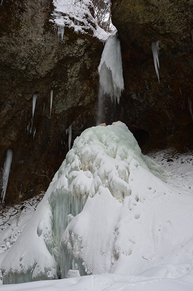
11. Garo-otaki Big Waterfall and Garo Gorge
→3-minute drive or 15-minute walk from the center to the waterfall and the gorge
Garo-otaki Big Waterfall, just beside Prefectural Road 317, spills out of the vegetation-rich V-shaped gorge. It is a sightseeing spot that can be enjoyed all year round. In summer, you can enjoy a dip in the water or “forest terapy”. In winter, you can see the frozen icicles all lit up. In autumnal leaves season, many photography enthusiasts visit here to capture the beautiful autumn colors. There is also a monument of Sugae Masumi, a travel writer in Edo era who wrote a poem about the place.
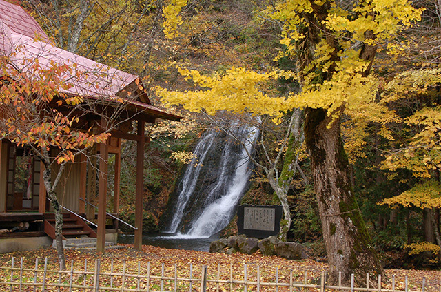
12. Choshi Waterfall
→3-minute drive or 10-minute walk from the center to the waterfall
Deep in Yunosawa Onsen Village, “Choshi”, which means a ceramic vessel for serving sake in Japanese gives its name to the waterfall whose power has carved a rounded hollow at the bottom. It is an unusual waterfall in that if you go underneath and look up, surrounded by rocks, you can see the water sliding off the shelf above your head 18 meters up. You can even go in behind the waterfall. *Park your vehicle in the dedicated visitor parking lot. Please do not park at “Yumoto Nagomi no Yu” onsen parking lot.